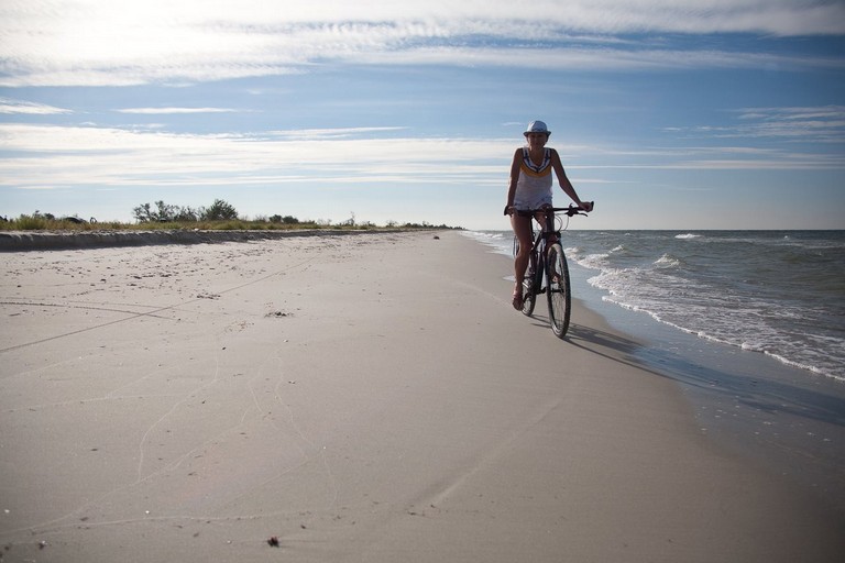
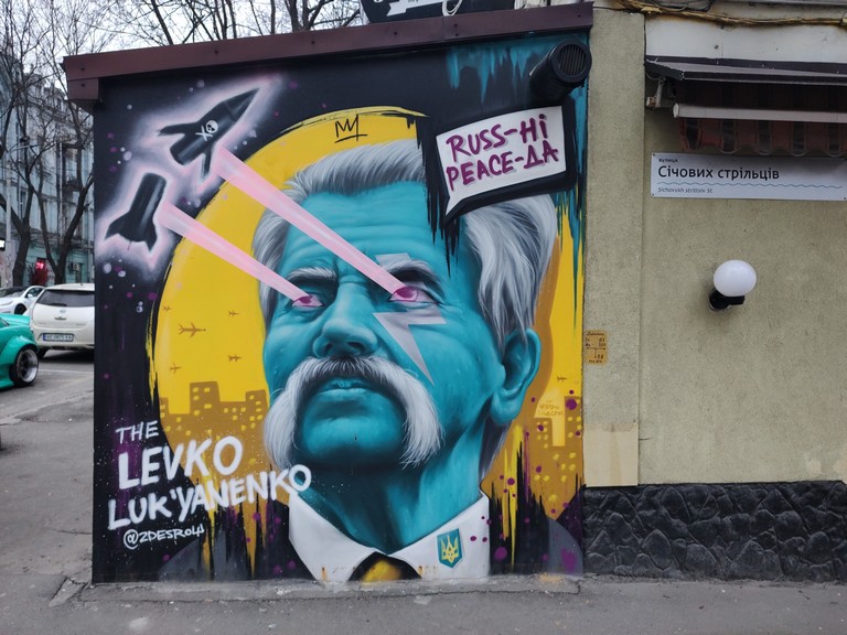
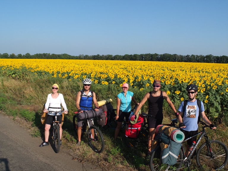
Кінбурнська коса — місце, де прісі води Дніпра змішуються з солоним Чорним морем. Фінішна точка велосипедного маршруту, унікальний природний комплекс, що поєднує багатство ландшафтів, рідкісні види флори та фауни, а також має глибоке історичне значення. Розташована між Дніпровсько-Бузьким лиманом і Чорним морем, вона приваблює дослідників, туристів та любителів природи своєю неповторною красою та біорізноманіттям.е
Рельєф та формування Кінбурнська коса є продовженням Кінбурнського півострова та частково відділяє Чорне море від Дніпро-Бузького лиману. Вона простягається на 45 км у довжину, а її ширина варіюється від кількох метрів у найвужчих місцях до кількох кілометрів. Рельєф коси переважно рівнинний, з піщаними дюнами та кучугурами, місцями залісеними штучними насадженнями сосни кримської та звичайної. Формування коси відбувалося під впливом морських течій, вітрів та накопичення піщаних відкладень та мушель, що створило цей унікальний ландшафт.
Флора Рослинний світ Кінбурнської коси надзвичайно багатий і налічує близько 600 видів вищих судинних рослин. Серед них особливу цінність становлять рідкісні та зникаючі види, занесені до Червоної книги України та Європейського червоного списку, такі як волошка короткоголова, ковила дніпровська, береза дніпровська, сон лучний та мачок жовтий. Унікальним є поле диких орхідей площею понад 60 гектарів — одне з найбільших у Європі. На дні прибережних водойм утворюються підводні луки з морської трави (Zostera marina, Zostera noltii), які служать середовищем існування для багатьох видів безхребетних та риб.
Фауна Тваринний світ коси не менш різноманітний. Тут мешкають олені, здичавілі коні та вовки. Серед рідкісних плазунів можна зустріти гадюку степову та сарматського полоза. У прибережних водах часто спостерігаються дельфіни та скати-хвостоколи. Пташиний світ представлений близько 300 видами, багато з яких занесені до Червоної книги України. Особливо вражають великі скупчення рожевих пеліканів у літній період та орланів-білохвостів узимку. Коса також є місцем найбільшої багатовидової колонії чапель на півдні України.
Історичне значення Кінбурнська коса має багату історію. Відомо, що перед походами на човнах князя Святослава тут організовувалися стоянки, які використовувалися для підготовки до експедицій. Також на території коси знаходиться заповідник «Білобережжя Святослава», який зберігає важливі природні комплекси та історичні пам’ятки, пов’язані з легендарним князем.
Національний природний парк “Білобережжя Святослава” У 2009 році територія Кінбурнської коси була включена до складу національного природного парку «Білобережжя Святослава». Парк охоплює понад 35 тисяч гектарів, включаючи 25 кілометрів білосніжних пляжів, унікальні природні комплекси та багатий тваринний світ. Його створення спрямоване на збереження та відновлення природних екосистем, а також на розвиток екологічного туризму в регіоні.
Змішання прісної та солоної води На краю Кінбурнської коси відбувається унікальне природне явище — змішання прісних вод Дніпровсько-Бузького лиману з солоними водами Чорного моря. Це створює особливі умови для існування різноманітних біоценозів та сприяє високій продуктивності екосистеми. Чітка межа між прісною та солоною водою часто помітна неозброєним оком, що додає краю коси особливого колориту.
Висновок Кінбурнська коса — це справжня перлина українського узбережжя, де гармонійно поєднуються унікальні природні ландшафти, багатство флори та фауни, а також глибока історична спадщина. Вона заслуговує на особливу увагу як об’єкт природоохоронного значення та місце для екологічного туризму, що дозволяє насолодитися незайманою природою та відчути дух історії.
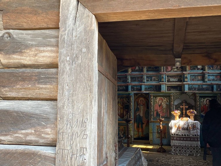
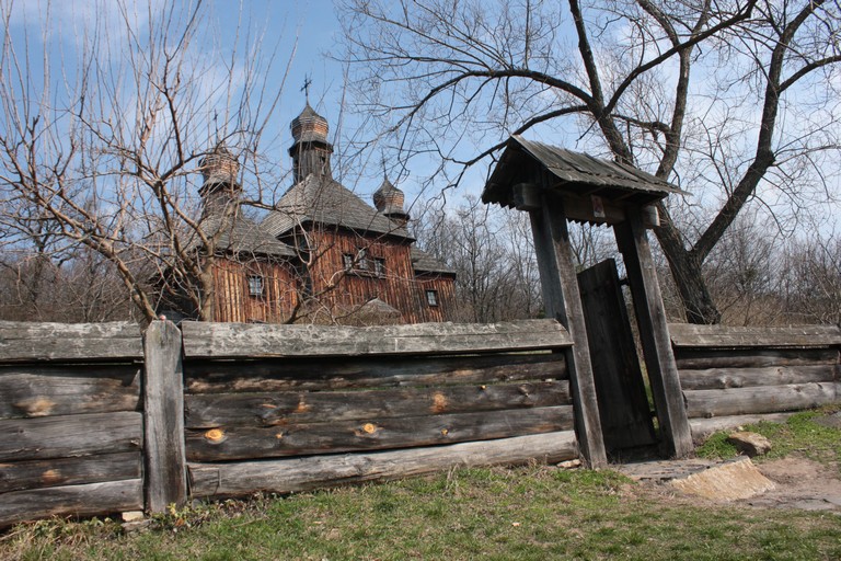
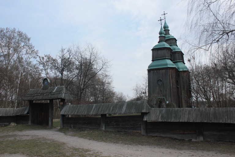
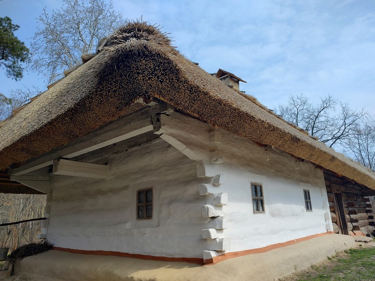
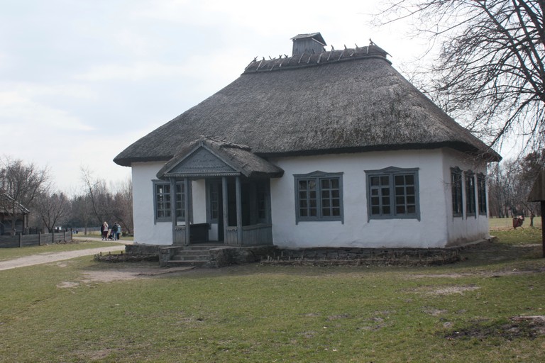
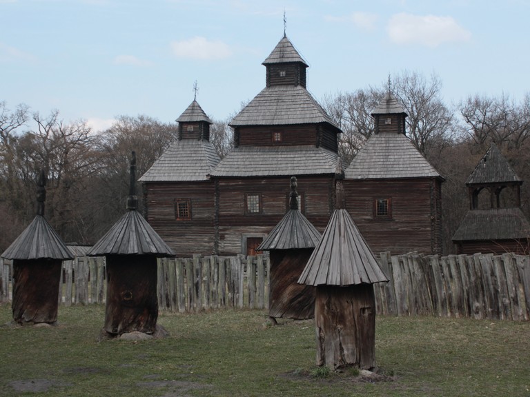
Pyrohiv is a unique open-air complex that has been preserving examples of traditional folk architecture and lifestyle from most of Ukraine’s ethnocultural regions for many decades.
Creation The first steps in implementing the project were taken with the involvement of specialists in history, architecture, and ethnography. Thanks to the efforts of state institutions and local communities, the search, documentation, and evacuation of unique structures from various corners of Ukraine was initiated. The buildings were carefully dismantled, transported, and restored at the new location while preserving their authenticity as much as possible. The museum was officially opened in the 1960s–70s, and since then it has been continuously enriched with new exhibits.
Transportation and Restoration Process Buildings were dismantled into individual components, enabling their transport from remote villages and regions. Once at the museum site, restoration work was carried out while preserving the original materials and structural integrity.
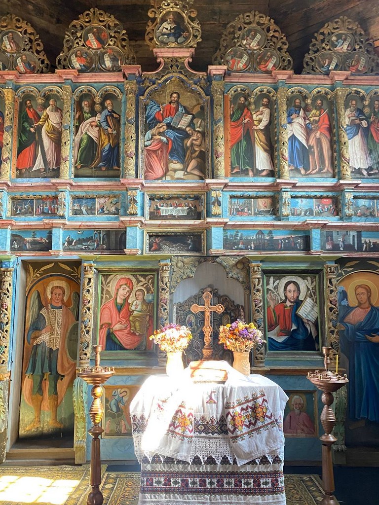
Restoration and Transport Experts meticulously restored each structure, preserving the authenticity of its form, finishes, and decorative elements. Authentic household items, craft workshop equipment (including drive mechanisms powered by a wheel turned by a horse), agricultural tools, furniture, icons, and more were also transported.
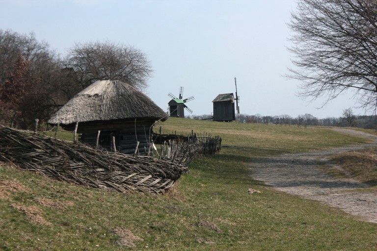
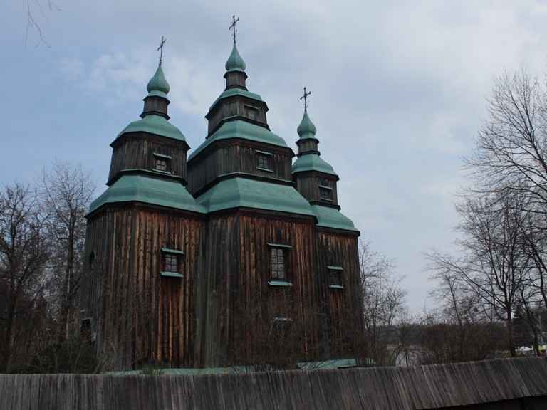
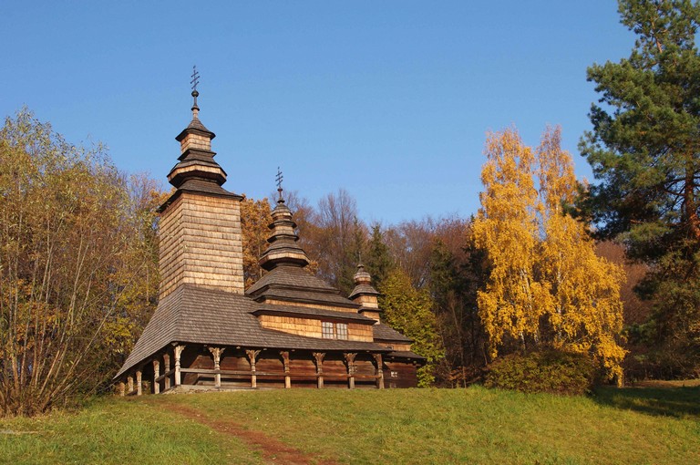
Displayed Regions The Pyrohiv Museum features examples of traditional architecture from most regions of Ukraine. Among them, the following stands out:
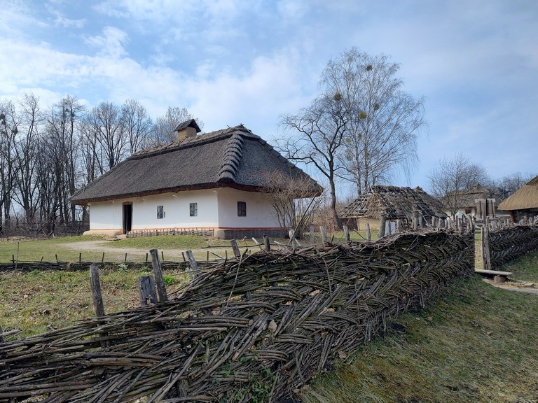
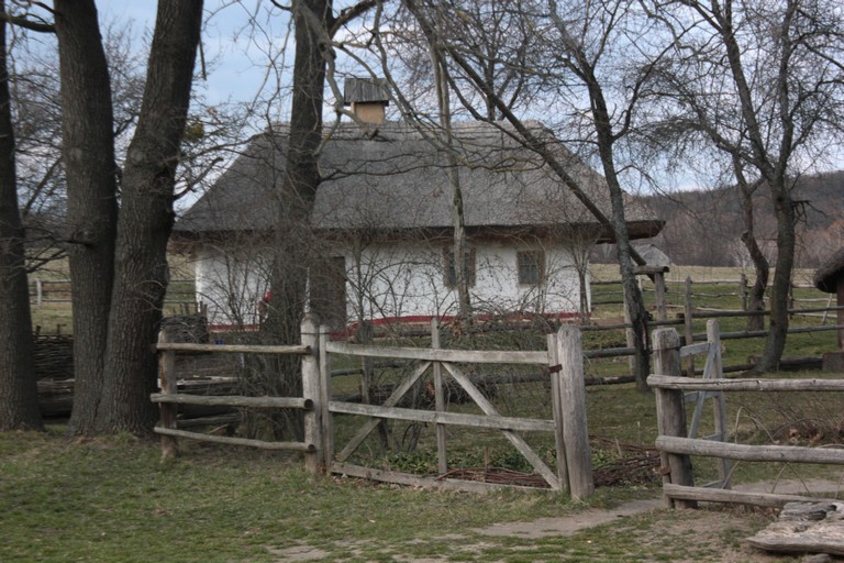
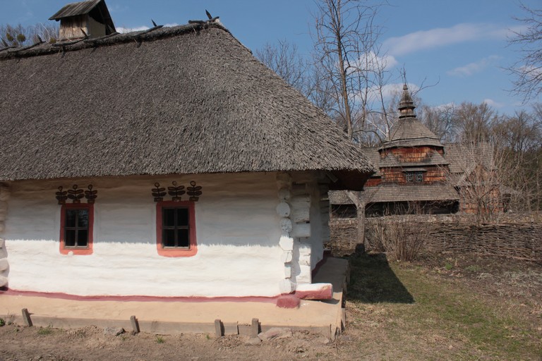
Central Dnieper Region (Середня Наддніпрянщина): Photos showcase typical Ukrainian houses with thatched roofs, stone churches, and outbuildings. They reflect the enduring traditions of rural life and a modest approach to decoration.
Церква Святої Параскеви із села ЗарубинціМихайлівська церква із села Дорогинка Київської областіЦерква Святої Параскеви із села ЗарубинціХата із села Таборів Київської областіШкола із села Лоташеве, Черкащина
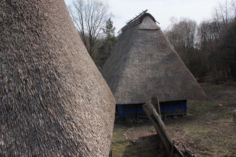
Полісся;
Воскресенська церква із села Кисоричі, Рівненщина
Poltavshchyna and Slobozhanshchyna
Podillia:
Хата із села Луги і Миколаївська церква із села Зелене
Carpathians
In the Carpathians, houses and outbuildings were often combined under one roof or built separately. Fences could be woven, wooden, or stone (often in the form of a rampart lined with thorn). Additionally, storerooms, barns, granaries, stables, pigsties, cellars, sheds, carriage houses, and other structures were erected. Sometimes, the yard was arranged as an enclosure, with all buildings forming a quadrangle that created a closed inner courtyard.
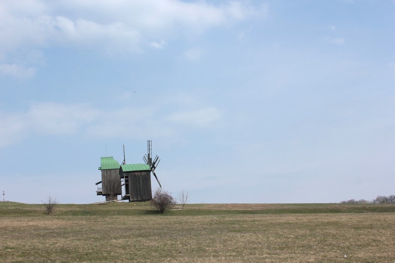
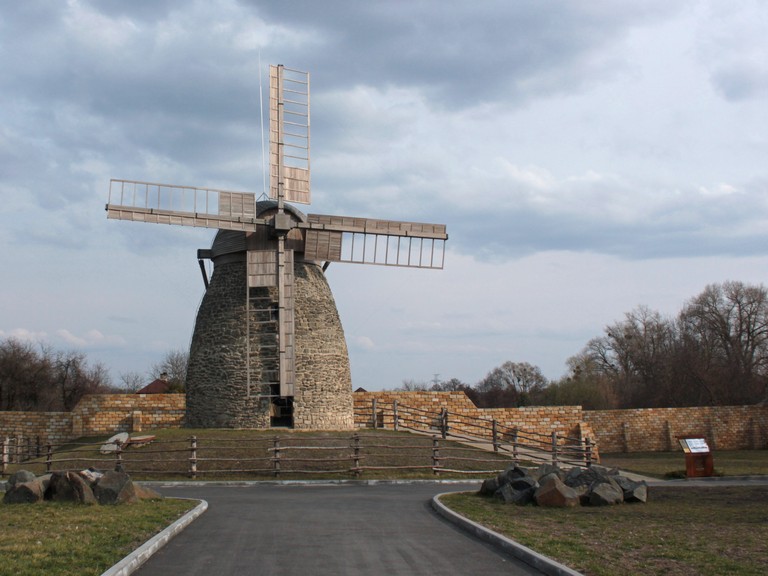
South
Кам’яний вітряк з села Олександрівка Білозерського району Херсонської області
Each region is represented by authentic exhibits that illustrate the multifaceted nature of Ukrainian folk architecture.
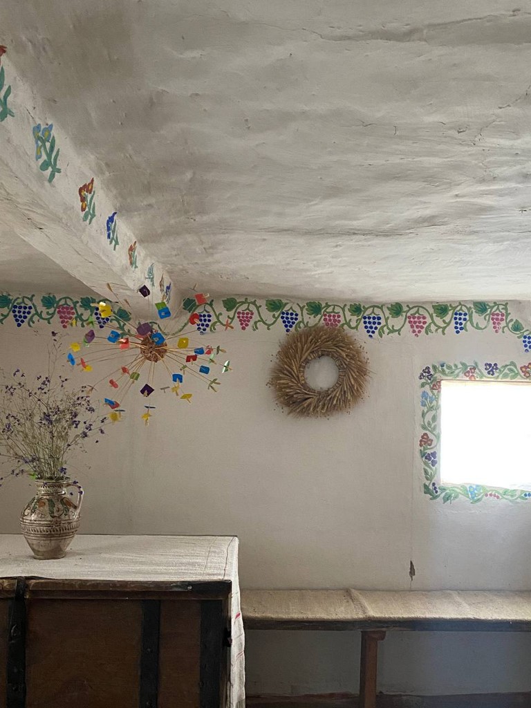
Materials and Conditions: The architecture of residential and utility buildings is shaped by natural and climatic conditions. The main materials are clay, wood, reed, and stone. In forested areas, wood is predominantly used; in the steppe, clay, straw, and stone prevail; while in the forest-steppe, a mix of materials is employed.
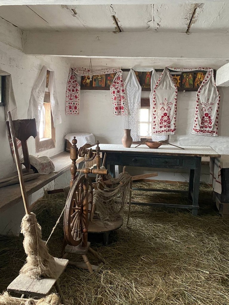
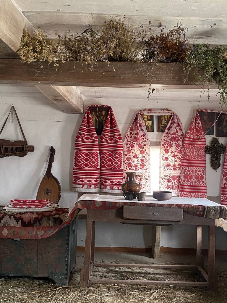
Typical Ukrainian House: Despite regional differences, the characteristic Ukrainian house is a three-part structure with an entrance on the southern side. The entrance leads into a vestibule, from which one section forms the “svitlytsia” (main living area) and the other a pantry. Partitions separating the rooms are known as “vankyr” (hidden rooms) and “hytia”/”hytka” (annexes).
At the entrance to the vestibule, a stove is positioned on one side, with a “mysnyk” (shelf for dishes) on the other. Between the stove and the wall is the “pil” – a sleeping area. In the “pokutia” (sacred corner), a table with benches and stools is placed, along with household icons adorned with flowers, herbs, and embroidered towels. Other furnishings include decorated chests, hanging rods for clothes, and, if there were infants, a cradle.
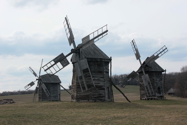
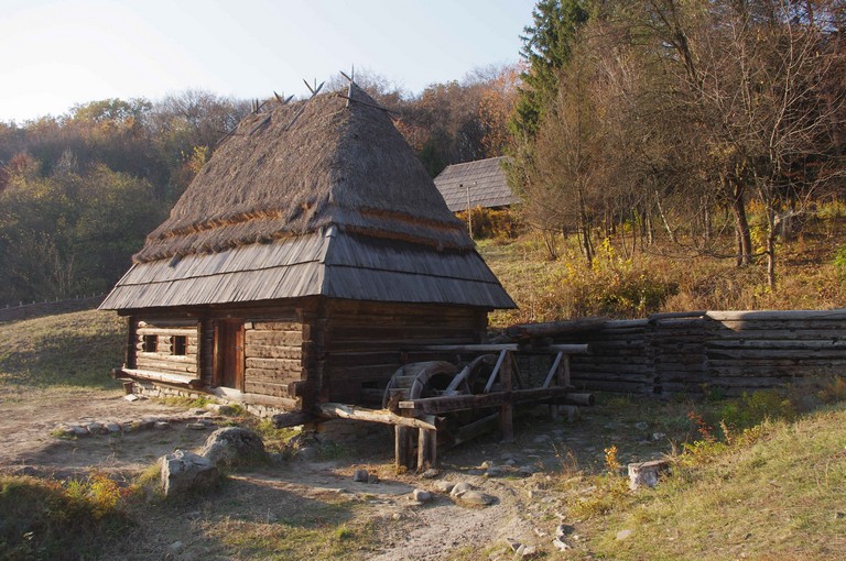
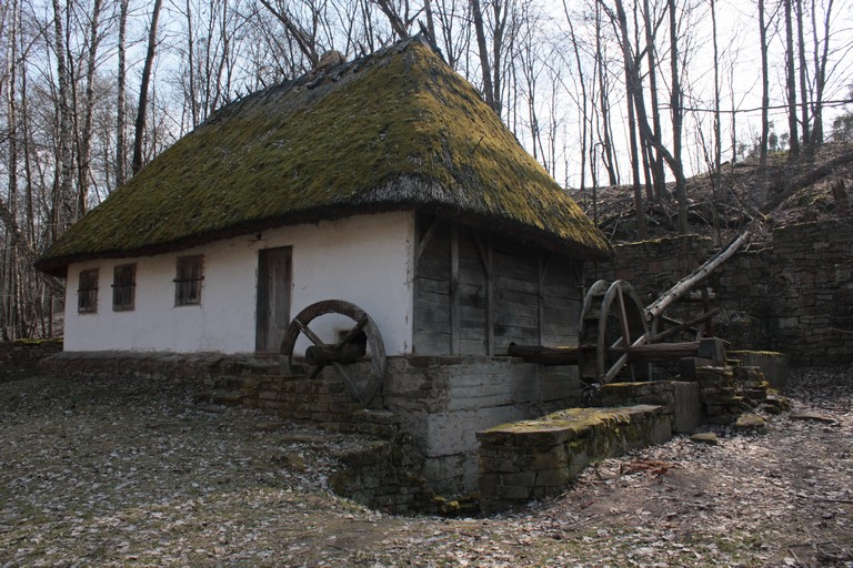
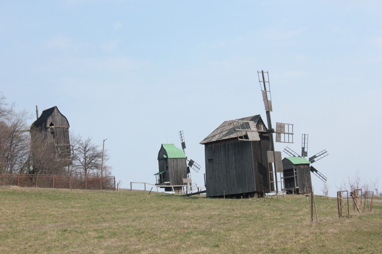
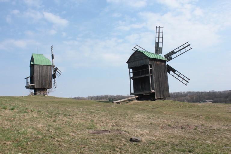
Mills
Water Mills: Appearing in the 12th century, they are classified into overflow (nalivni) and underflow (pidlyvni) types, with the former being more common. Like windmills, they became a significant part of the local landscape.
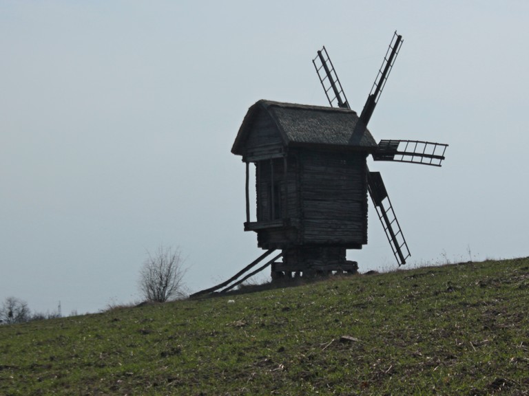
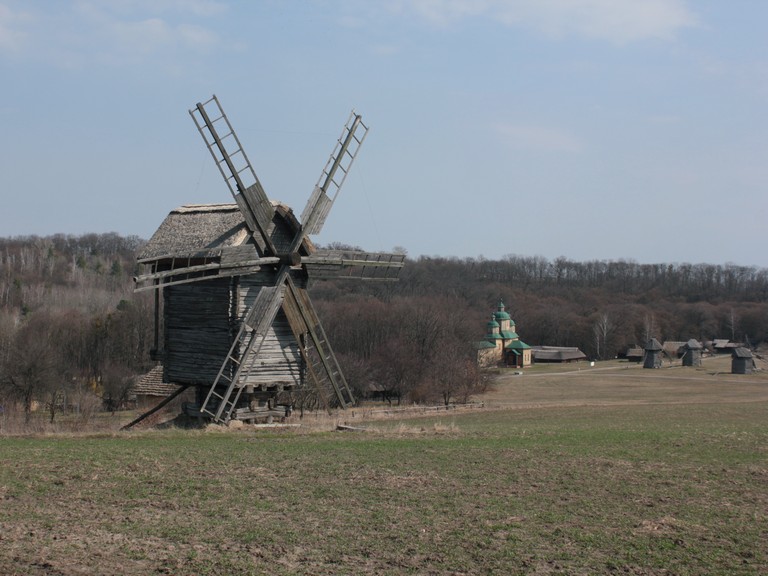
Windmills
Windmills are structurally divided into two types: post mills (kozlovi) and tower mills (shatrovi).
Post mills, considered the older type, were introduced to Ukraine through German influence, which is why they are sometimes called German mills.
Tower mills, which emerged in Holland around 1650, are also known as Dutch mills.
Post Mills
The windmill’s body, including the grain-grinding mechanism, shaft, and sails, is mounted on a fixed base. Rotation is achieved using a long guiding beam that allows the structure to turn around a sturdy post anchored in the ground or on a cross-shaped foundation.
Tower Mills
In tower mills, the main body remains stationary (typically octagonal or circular, tapering upwards for stability), while only the roof, along with the sails and shaft, rotates to adjust to the wind direction.
Working Principle
Regardless of type, wind power turns the sails, which transfer motion to a horizontal shaft. Inside the structure, a large wooden gear wheel transmits movement through a spindle mechanism to the upper millstone, while the lower one remains fixed. Grain is fed into a hopper with a chute, and the “konyk” device ensures even distribution by vibrating. The milling fineness is adjusted by raising or lowering the upper millstone.
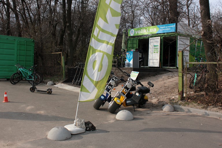
Cycling Route in Pyrohiv
The open-air museum not only preserves history but also integrates modern recreational activities. Visitors can explore the entire museum by bike, following a designated cycling route, with bicycle rentals
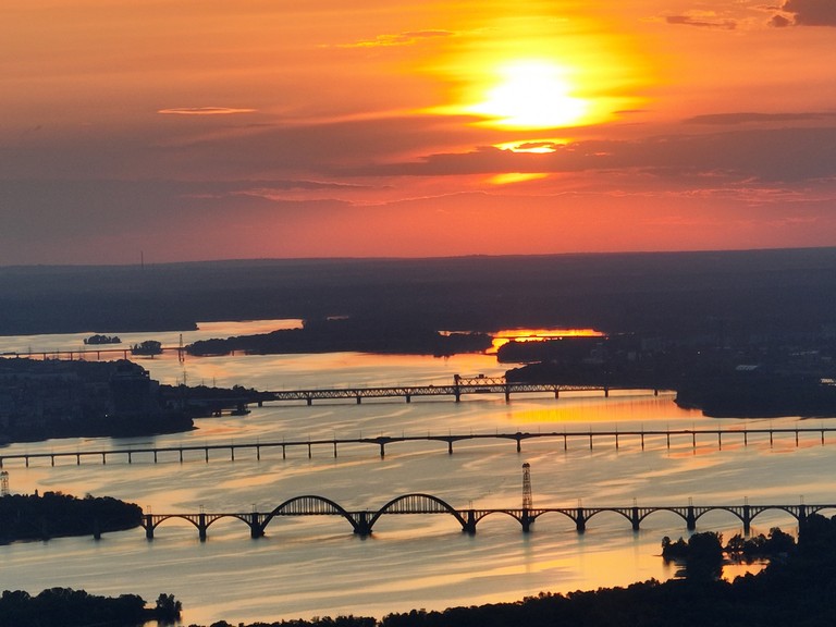
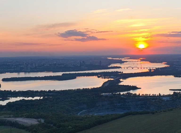
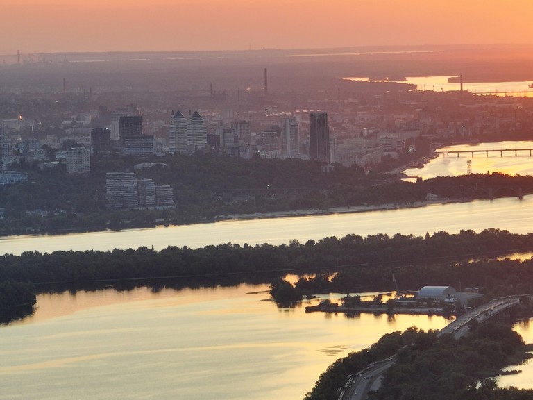
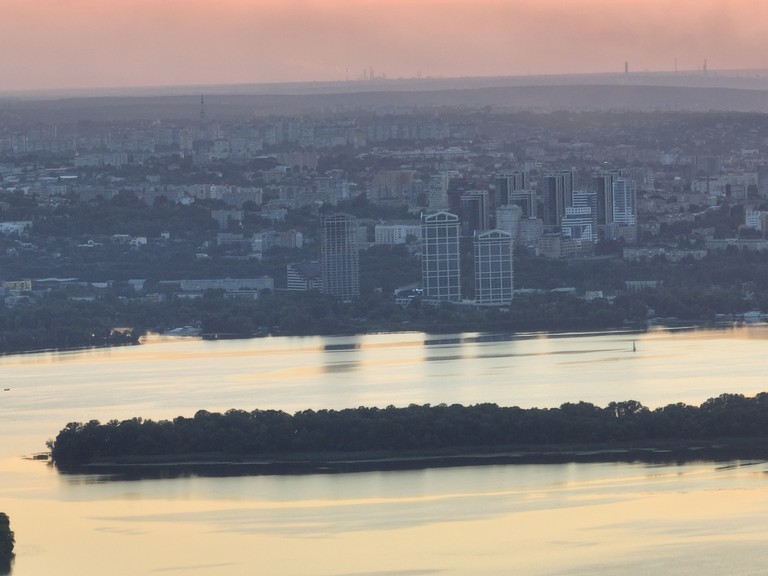
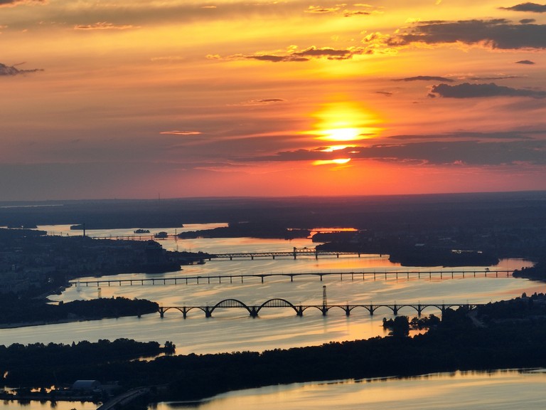
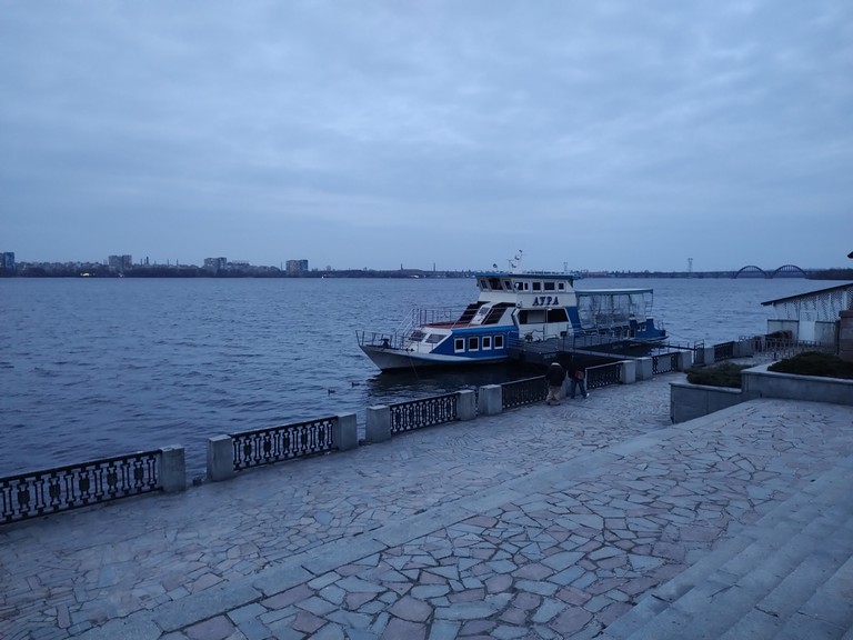
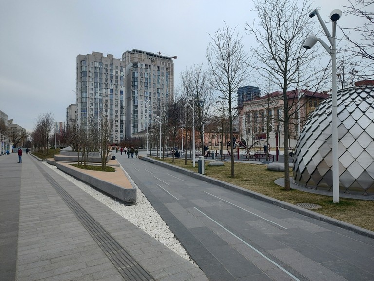
Dnipro is located at the confluence of the Samara, Oril, and Mokra Sura rivers with the Dnipro River. The city serves as the administrative center of Dnipropetrovsk Oblast and the Dnipro urban community. It is the fourth-largest city in Ukraine by population. Dnipro is a major scientific and innovation hub, known as the “space capital” of Ukraine, and is also home to the longest embankment in Europe.
Захід над Дніпром
Thanks to its advantageous location, it has always been an important transportation hub.
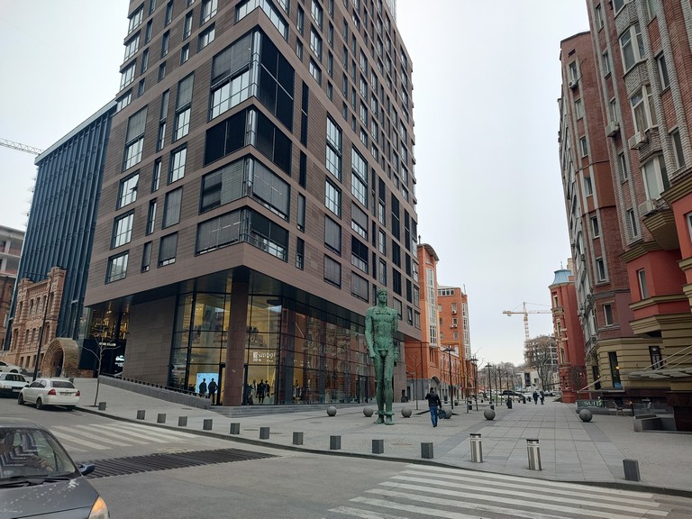
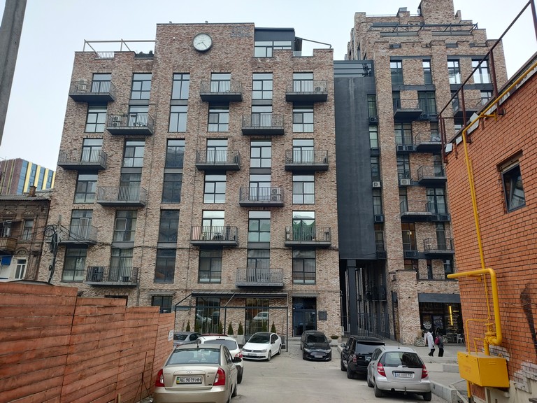
Дніпро на Дніпріновобудови в центрі
History: From Ancient Times to the Present
Earliest Settlements
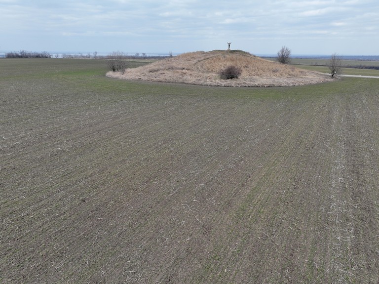
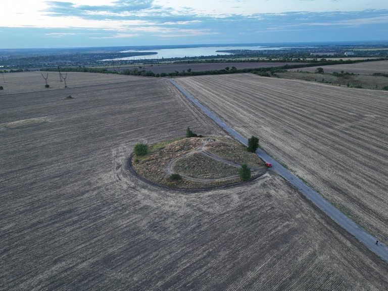
People have lived in the area of modern-day Dnipro for over 100,000 years. Archaeological findings include Paleolithic sites, Trypillia culture settlements, Scythian burial mounds, and traces of the Chernyakhiv culture. One of the most significant archaeological landmarks is Hostra Mohyla, a burial mound believed to be the remains of an ancient Scythian settlement. It has become a symbol of the region’s centuries-old history.
Paleolithic and Neolithic
Numerous archaeological sites in Dnipro indicate human presence as far back as the Middle Paleolithic period (100,000–40,000 years ago). Primitive hunter-gatherer camps have been discovered in several locations, including:
Romankove (western part of Kamianske)
Vasylivka village (Synelnykove Raion)
Skubova Balka (near modern Dnipro)
During the Neolithic period (5500–4000 BCE), the first agricultural and pastoral settlements emerged. Excavations on the Igren Peninsula have revealed remnants of a settlement with pottery, stone tools, and semi-subterranean dwellings.
Eneolithic and Bronze Age: Yamnaya Culture
At the turn of the 4th–3rd millennium BCE, the region was inhabited by the Yamnaya culture, known for its burial mounds. Significant findings from this culture have been uncovered at Storozhova Mohyla, Mykhailivske settlement, and Skeli Kamenolomni.
Trypillia Culture
Settlements of the Trypillia culture (4th–3rd millennium BCE) have been discovered in the region, indicating early agricultural communities. Their pottery, adorned with intricate geometric patterns, has been found in various parts of the oblast.
Scythian Period
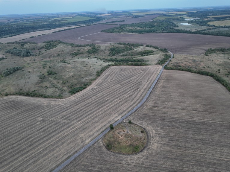
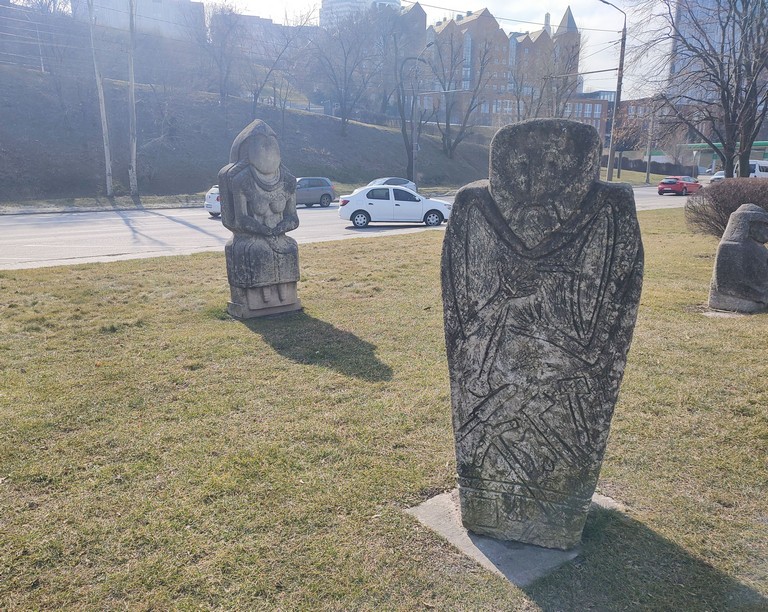
Between the 7th and 3rd centuries BCE, the territory of modern Dnipro was part of the Scythian lands. Archaeologists have uncovered around 9,500 burial mounds, including the famous Tovsta Mohyla and Hostra Mohyla, which contained the graves of Scythian nobility, complete with gold ornaments and weapons.
Cossack Era and the Founding of the City
From the 15th to the 18th century, this land was part of the Zaporizhzhian Host’s Free Lands. Cossack settlements existed in what is now Dnipro, including Polovytsia Sloboda and the town of Novi Kodaky.
In 1776, following the destruction of the Zaporizhzhian Sich, the city of Katerynoslav was founded. Initially planned for the right bank of the Dnipro, it was relocated to its present site in 1787 due to unfavorable conditions. In the 19th century, with the discovery of iron ore deposits in Kryvyi Rih, Katerynoslav rapidly developed into a major industrial center.
20th Century: Industrial Hub and Space Industry
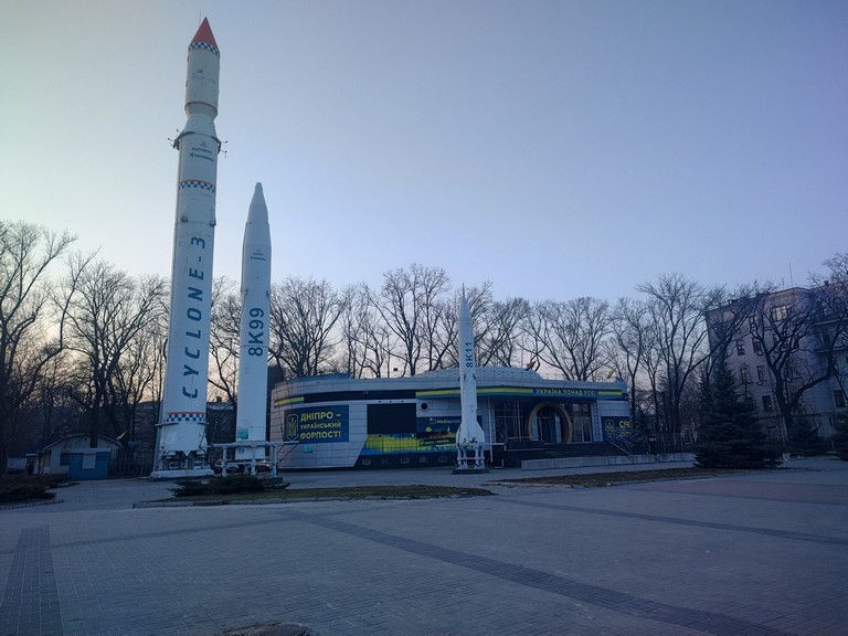
In the 20th century, Dnipropetrovsk became one of the Soviet Union’s key centers for metallurgy, defense, and space industries. The Pivdenmash (Yuzhmash) plant played a crucial role in missile and rocket production, making the city a strategic hub for aerospace engineering. Due to its military significance, Dnipropetrovsk remained a closed city until the 1990s.
пам’ятник Шевченку
Revolution of Dignity and the Russo-Ukrainian War
During the Revolution of Dignity (2013–2014), Dnipro became one of the centers of protest. In 2014, with the outbreak of war in eastern Ukraine, the city welcomed thousands of displaced persons and became a key hub for volunteer efforts and military rehabilitation. During the full-scale invasion in 2022, Dnipro suffered missile attacks but remained a crucial logistics and support center for Ukraine’s defense.
Bridges of Dnipro
Amur Bridge – One of the oldest, built in 1944 after World War II.
Kaydatskyi Bridge – Connects the central part of the city with the left bank.
Merefa-Kherson Bridge – A unique railway bridge with an arched design.
Central Bridge – The main transportation link between both riverbanks.
Southern Bridge – The most modern, opened in the 2000s.
мости через Дніпро
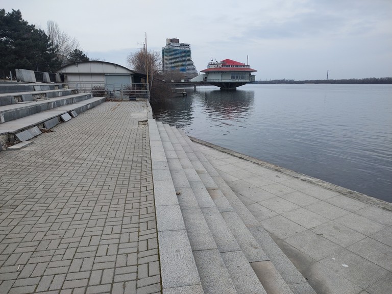
Dnipro Embankment
Dnipro boasts the longest embankment in Europe, stretching over 23 km along the right bank of the river. It consists of several sections:
Old Embankment (Stara Naberezhna) – The historic section featuring architectural landmarks.
нова Набережна
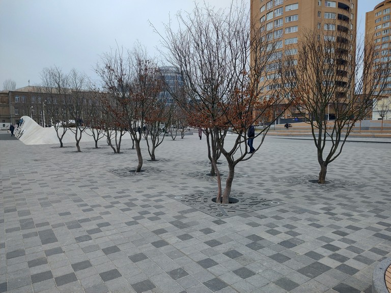
New Embankment – A modern area with parks, bike lanes, and a skate park.
Dnipro’s Bike Lane – One of the longest in the country, designed for comfortable walks and training.
Dnipro is a city with a centuries-old history, combining ancient archaeological sites, Cossack heritage, industrial development, and modern urbanism. It remains a key center for science, industry, and volunteer movements in Ukraine.
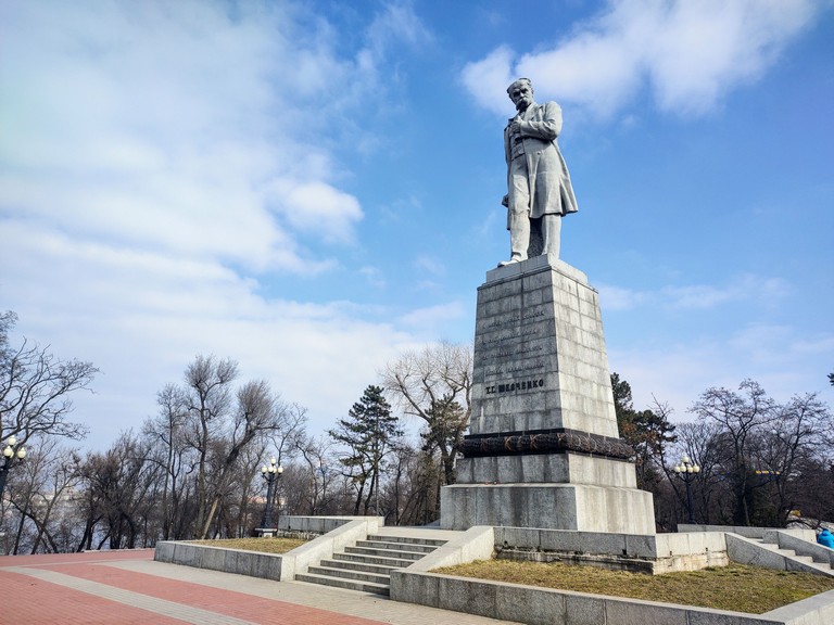
Dmytro Yavornytsky
One of the most prominent figures associated with the city of Dnipro is Dmytro Ivanovych Yavornytsky (1855–1940), a historian, archaeologist, ethnographer, writer, and researcher of Ukrainian Cossack history. His life and work were deeply intertwined with this region, particularly in researching the Zaporizhian Sich and its legacy.
Research and Expeditions
For many years, Yavornytsky organized archaeological excavations and ethnographic expeditions across lands connected to the Zaporizhian Cossacks. He extensively studied the remnants of ancient settlements, fortresses, burial mounds, and also recorded folk tales and songs preserved in the collective memory. His expeditions along the Dnipro River were particularly significant, as he studied the legendary Dnipro Rapids, which played a crucial role in the Cossack route to Zaporizhzhia.
Yavornytsky didn’t just study history in the field, but also aimed to preserve its memory. He actively photographed landscapes, Cossack graves, historical landmarks, and the Dnipro Rapids, which were soon to be submerged by the DniproHES. Thanks to his photographs and sketches, we have a record of these natural formations before their flooding.
Books and Scientific Legacy
Yavornytsky authored several fundamental works, including the three-volume “History of the Zaporozhian Cossacks” (1892–1897), which became a classic on the Cossack era. He also wrote numerous monographs, articles, and reference books, such as “Zaporizhzhia in the Remains of Antiquity and Folk Traditions” (1888), “Following the Footsteps of the Zaporozhians” (1898), and “The Freedoms of the Zaporozhian Cossacks” (1890). His works contain invaluable information about the daily life, customs, traditions, and military arts of the Cossacks.
A notable work is his book “Dnipro Rapids”, published in 1928, in which he meticulously described all nine major rapids of the Dnipro, their history, legends, folk tales, and geographical features. This book remains a unique source of information about a part of the Dnipro that vanished after the construction of the Dnipro Hydroelectric Power Station.
Yavornytsky Museum
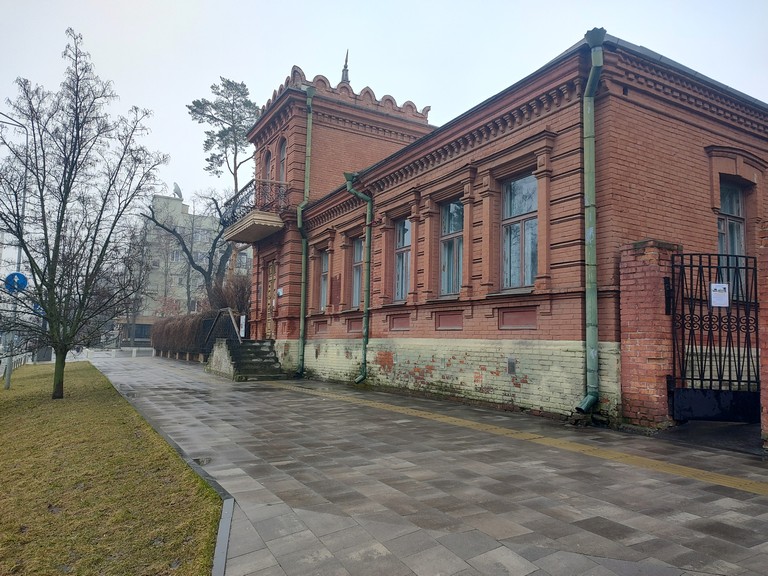
In 1902, Dmytro Yavornytsky became the head of the Katerynoslav Historical Museum (now the Dmytro Yavornytsky National Historical Museum of Dnipro), where he worked for nearly 30 years. Thanks to his leadership, the museum became one of the leading historical institutions in Ukraine, with its collection enriched by unique exhibits, including Cossack insignia, weapons, ancient maps, and documents.
музей ЯворницькогоБудинок Яворницького
Dmytro Yavornytsky Street
In honor of the renowned historian, the main street of Dnipro is named Dmytro Yavornytsky Avenue (formerly Karl Marx Avenue). It runs through the center of the city and is one of its most important thoroughfares. In this way, the name of the researcher is forever etched in the history of Dnipro, and his legacy continues to live on in the city’s culture and collective memory.
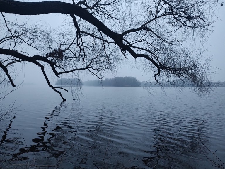
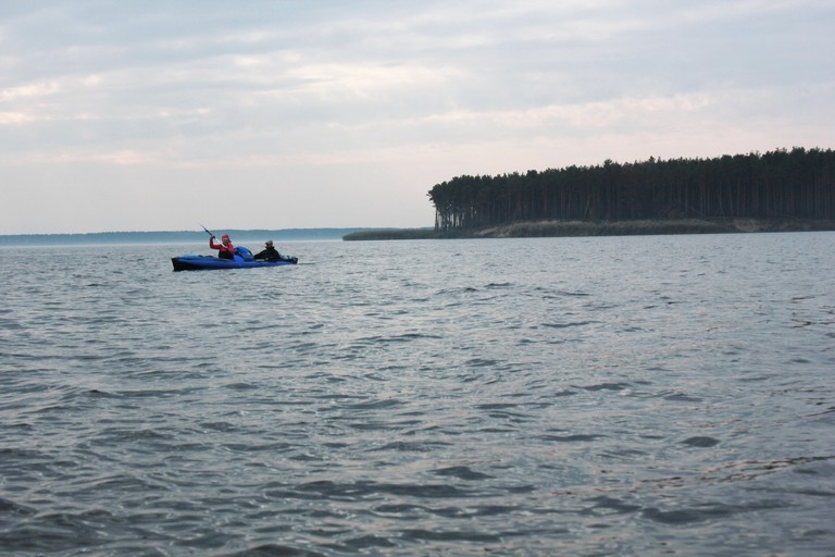
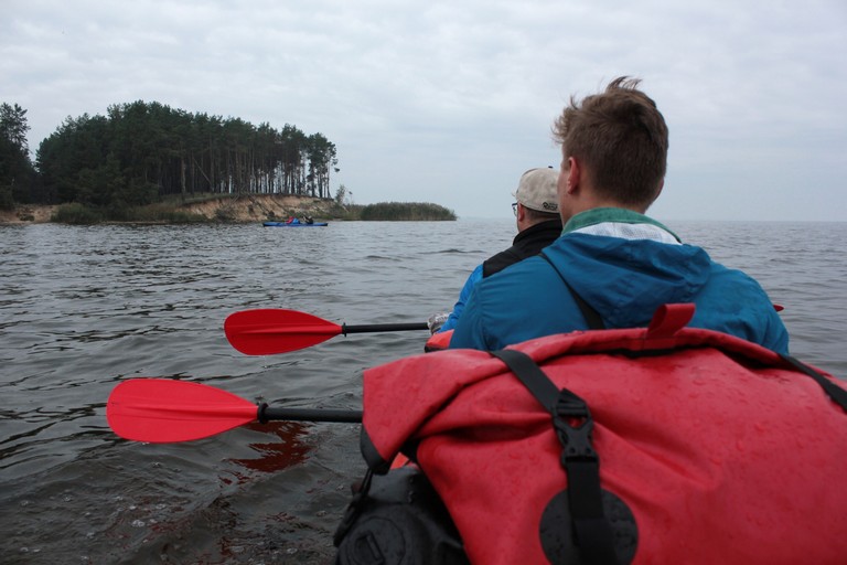
Hilcha Island is an island on the Kyiv Reservoir, part of the Dnipro-Teteriv National Park. It attracts travelers with its wild, untouched beauty, rich nature, and the unique atmosphere of a deserted island.
острів Хільча
Where is Hilcha located?
The island is situated opposite the Teteriv River delta on the Kyiv Reservoir. It can only be reached by boat. The most convenient starting points are Sukholuchchia or Strakholissia.
острів з підня
Nature and Geography of Khilcha Island
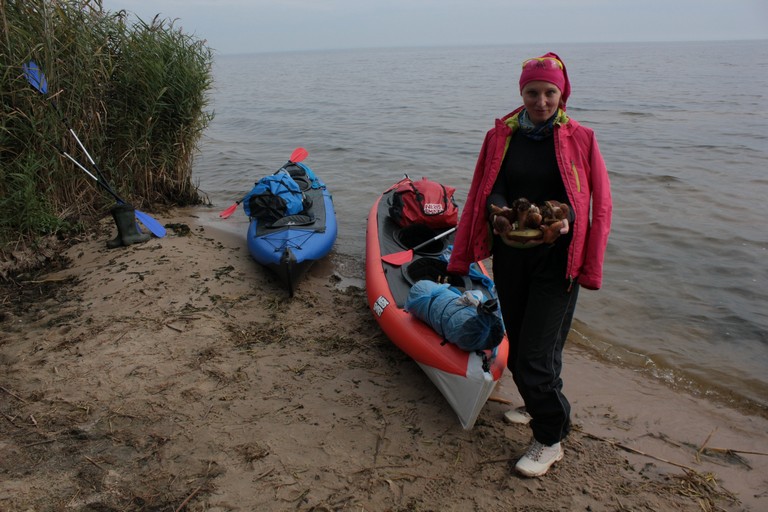
Khilcha is a combination of forested areas, marshy patches, and sandy shores. Tall willows and poplars grow here, providing natural shade and shelter from the wind. The island has a winding coastline with small, cozy bays, perfect for docking a kayak.
In spring and autumn, the water level can fluctuate, creating temporary lagoons and islands with sandy spits. This place is ideal for birdwatching, as you can spot herons, storks, eagles, and even the rare black stork.
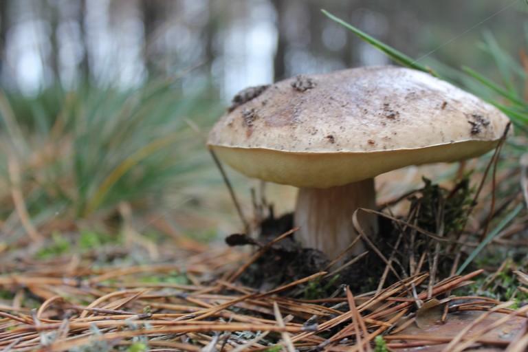
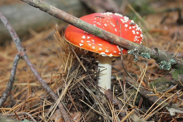
The Mushroom Kingdom of Khilcha
The island is particularly interesting for mushroom enthusiasts. The white mushrooms here grow just like in the Carpathians! In addition, there are many moss mushrooms, honey mushrooms, and fly agarics.
назбирали грибів на юшку
For a one-day kayak trip, Khilcha is just what you need!
However, if you’re looking for longer distances and more adventures, there is also Berizky Island, located in the old Dnieper riverbed, before it was flooded by the reservoir. On this island, there are convenient spots for camping overnight in tents.
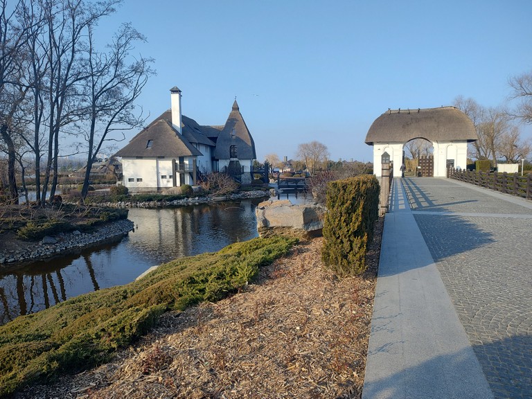
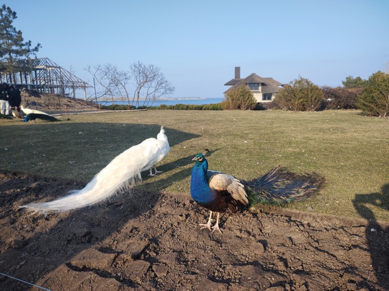
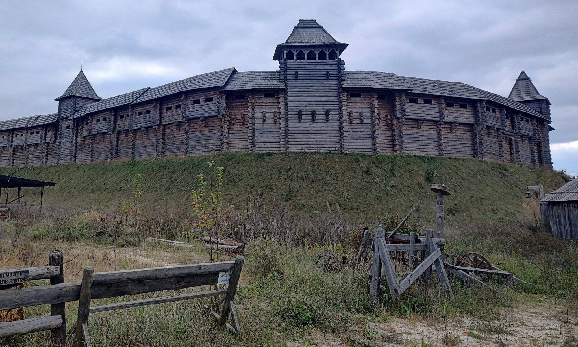
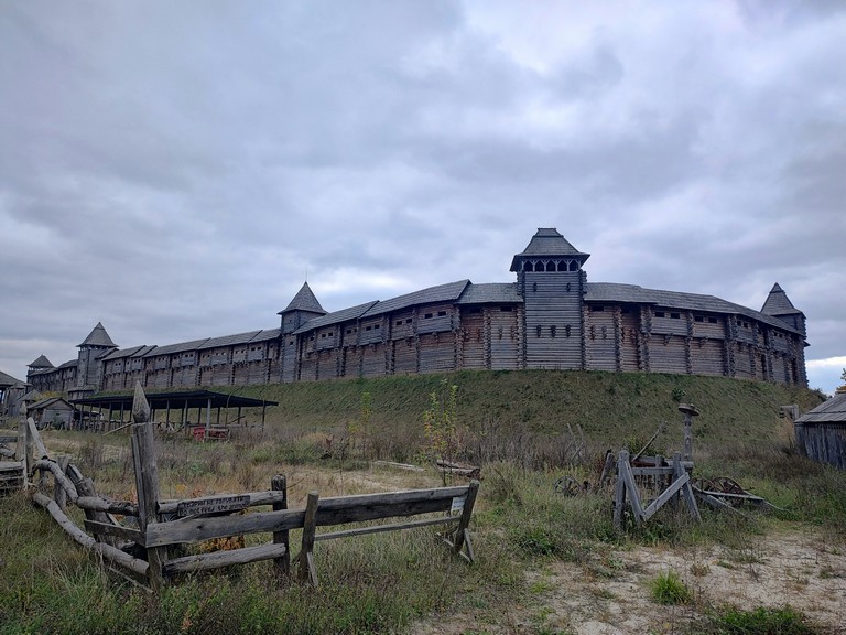
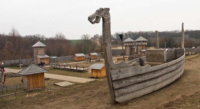
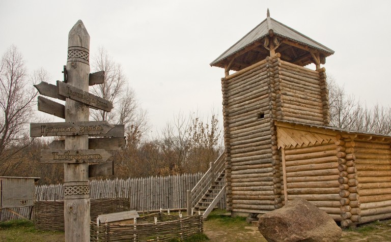
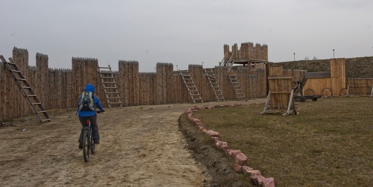
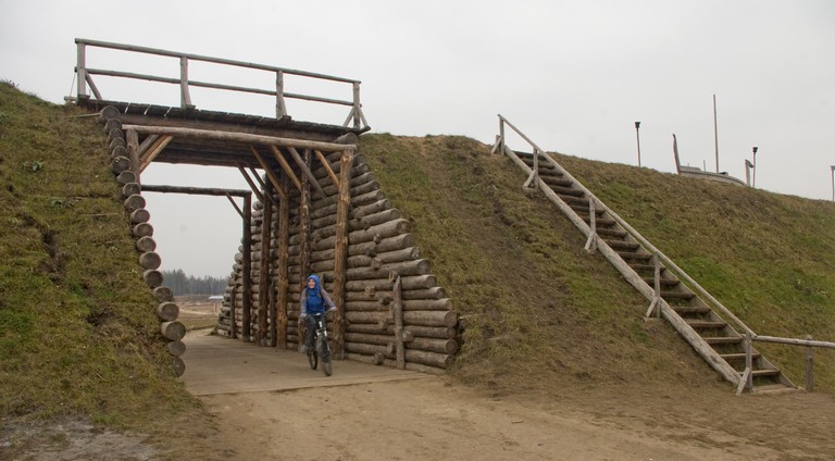
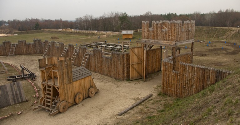
The “Kyivan Rus” Park is situated on a hill above the Stuhna River.
парк Київська Русь
It is a historical and cultural complex where an enclosed medieval city has been reconstructed based on archaeological and historical research. The main part is a recreation of the Kyivan citadel from the 10th–13th centuries, featuring wooden walls, towers, and a central square. There are also residential and utility buildings, a blacksmith’s workshop, guard towers, and stables.
копія човна часів Русі
The park’s territory is quite large, with wooden galleries running along the fortifications, offering panoramic views of the central courtyard and the surrounding landscape. Visitors can observe historical reenactments of daily life, watch equestrian performances, try traditional crafts, or simply stroll through the recreated historical setting. During the warmer months, the park hosts historical reenactment tournaments.
вежа
During the warmer months, the park hosts historical reenactment tournaments. There is also a guest yard on-site where visitors can have a meal or stay overnight.
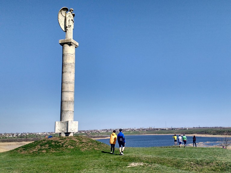
The Tiahyn Fortress is a unique historical landmark located in the village of Tiahynka, Beryslav district, Kherson region. It was built in the late 14th – early 15th century at the initiative of Grand Duke Vytautas of Lithuania. This site played a key role in medieval trade and military conflicts in southern Ukraine.
Тягинська фортеця
Geographical Location
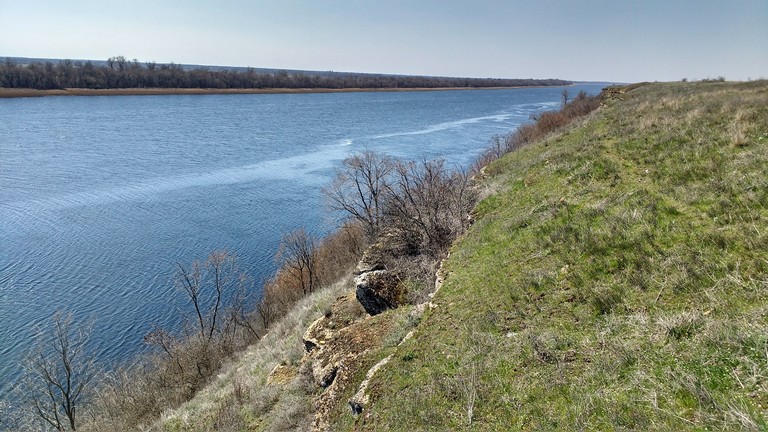
The Tiahyn Fortress was strategically located on the right bank of the Dnipro River, near the confluence of the Tiahynka River. A steep promontory, surrounded by water on three sides, provided natural protection.
Дніпро біля Тягинки
This location had several important advantages:
Control over water routes. The Dnipro River was a major transportation artery connecting the Black Sea region with Kyiv, Lithuania, and Europe. The fortress allowed control over the movement of merchants, military forces, and travelers.
Proximity to trade routes. Due to its location near key trade routes, the fortress served not only as a defensive stronghold but also as a significant trading port.
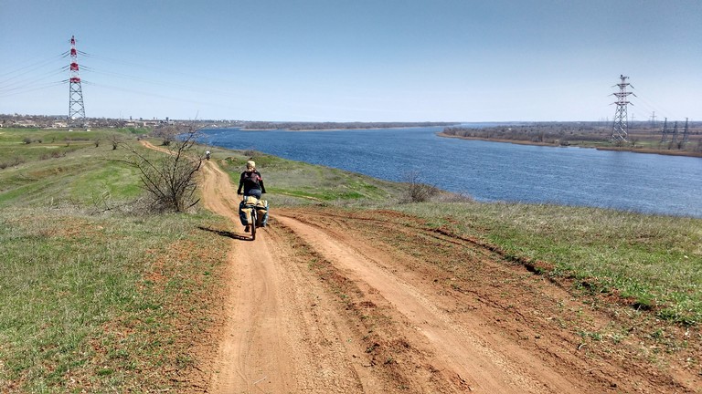
ґрунтовка вздовж Дніпра
Fortress and Historical Events
The Tiahyn Fortress was a key stronghold in the struggle for influence in the region. It frequently changed hands between the Lithuanians, Tatars, Turks, and Cossacks. In 1492, one of the first documented campaigns of the Ukrainian Cossacks took place near Tiahyn, when Prince Bohdan Hlynskyi’s detachment attacked a Tatar ship in the Dnipro estuary.
What’s Interesting for Tourists?
Today, Tiahyn Fortress is a place where visitors can not only see the remnants of ancient walls and towers but also experience the atmosphere of medieval Ukraine. Tourists can enjoy scenic views of the Dnipro River and take a walk along the picturesque banks of the Tiahynka River.
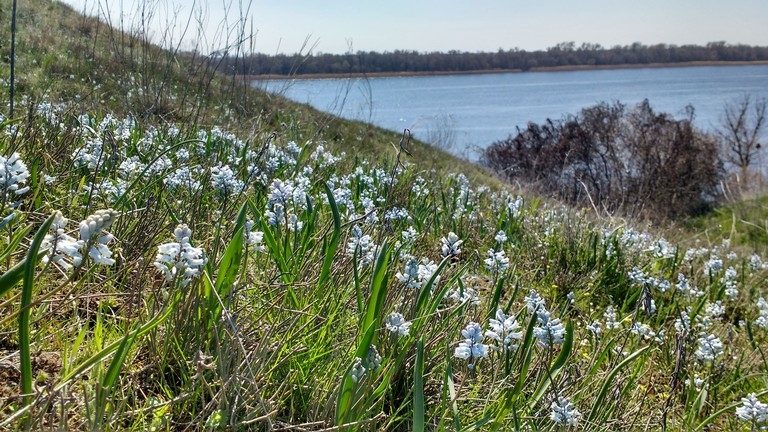
Пушкінія пролісковидна на Дніпровських кручах
This location is perfect for history tourism enthusiasts, researchers of ancient civilizations, and those seeking new travel routes across Ukraine.
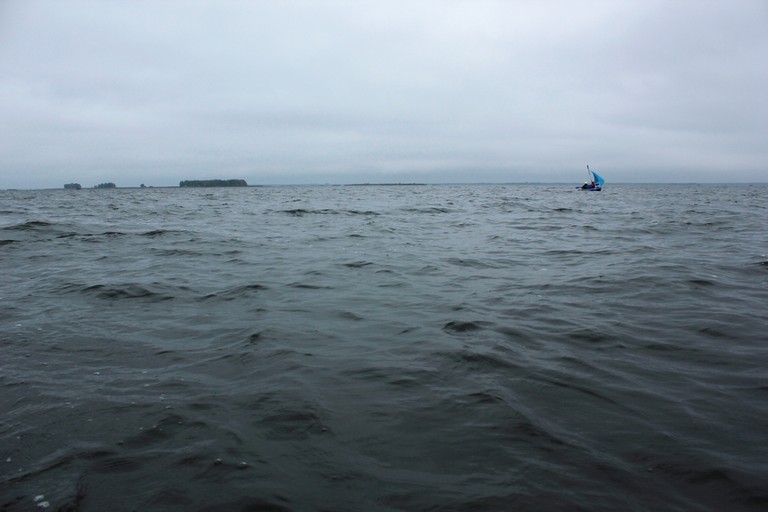
Київське водосховище, або Київське море, з’явилося у 1964 році після будівництва Київської ГЕС. Ця штучна водойма кардинально змінила природу Київського Полісся, затопивши понад 50 сіл та історичні місцевості. Сьогодні це місце є поєднанням втраченого минулого, дикої природи та сучасних екологічних викликів.
Київське море
Затоплені села та історичні місцевості
Під водами Київського моря зникли давні поселення, серед яких були місця з історією, що згадуються у літописах Київської Русі, стоянки первісних людей.
Старосілля (Ольжич) – поселення XI століття, знищене повністю.
Ошитки – мало дерев’яну церкву XVIII століття, яка не пережила затоплення.
Сваром’я – одне з найбільших рибальських сіл регіону.
Тарасовичі – козацьке поселення, відоме переправами через Дніпро.
Новий Глібів і Старий Глібів – містили залишки давньоруських городищ.
Перед затопленням археологи намагалися врятувати артефакти, але значна частина залишків будівель, кладовищ та церков безслідно зникла під водою.
Тваринний і рослинний світ Київського моря
Незважаючи на своє техногенне походження, Київське море стало новим домом для різноманітних видів риб, птахів і звірів.
Орлан-білохвіст – хижий птах, що гніздиться на берегах водойми.
Скопа – рідкісний вид, що з’явився тут після утворення водосховища.
Сірий журавель – мешкає на заболочених островах Київського моря.
Тварини:
У прилеглих лісах мешкають лосі, козулі, дикі кабани, бобри.
Уздовж берегової лінії часто зустрічаються видри, які полюють на рибу.
Рослинність:
На мілинах сформувалися очеретяні та болотяні зарості, що стали природним фільтром для водосховища.
У соснових і мішаних лісах уздовж берегів ростуть чорниця, брусниця, папороть, лікарські трави.
Чорнобильський радіаційний заповідник та Київське море
Північна частина Київського водосховища входить до зони відчуження ЧАЕС і є частиною Чорнобильського радіаційно-екологічного біосферного заповідника.
Територія майже не зазнала впливу людини з 1986 року, що дозволило природі відновитися.
Тут мешкають рисі, вовки, чорні лелеки, орлани та рідкісні види ссавців.
Радіаційний фон у водоймі вищий, ніж у середньому по Україні, але не становить безпосередньої загрози для риби та тварин.
Науковці досліджують, як природа адаптується до умов забруднення, і виявили, що багато видів тут розмножуються швидше, ніж у регіонах з людською активністю.
Туризм, спорт та відпочинок на Київському морі
Вітрильний спорт– Київське море є чудовим місцем для яхтингу завдяки великим відкритим просторам і стабільним вітрам. Тут регулярно проводяться регати, прогулянкові подорожі, навчання капітанів яхт.
Рибальський туризм – водосховище славиться великою кількістю риби, що приваблює рибалок з усієї України.
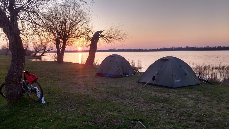
Кемпінг і відпочинок на островах – уздовж берегів Київського моря розташовані дикі пляжі та мальовничі острови, ідеальні для ночівлі в наметах.
Кайтсерфінг та віндсерфінг – завдяки великим відкритим просторам і вітряним умовам Київське море є одним із чудових місць для цих видів спорту в Україні.
Тріатлон і плавання на відкритій воді – організовуються запливи та тренування для спортсменів-аматорів та професіоналів.
Веслування на байдарках і каное – як для аматорських подорожей, так і для тренувань професійних спортсменів.
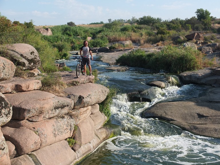
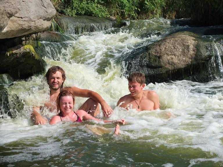
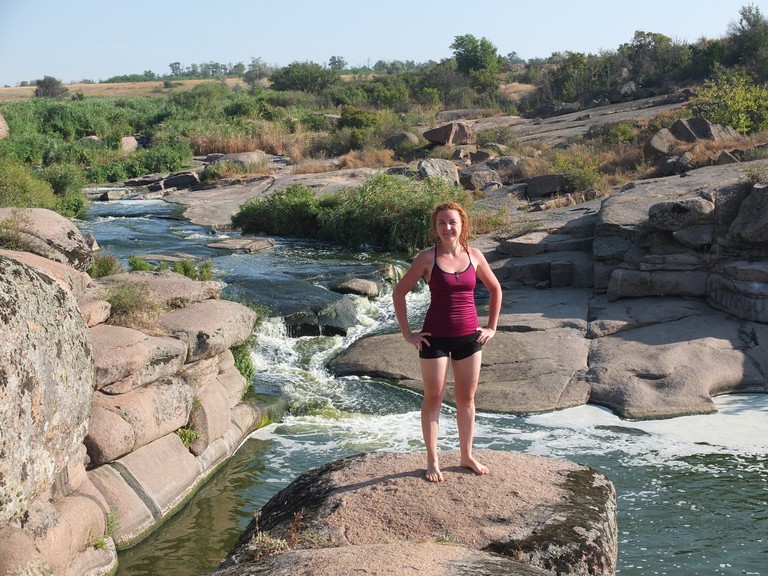
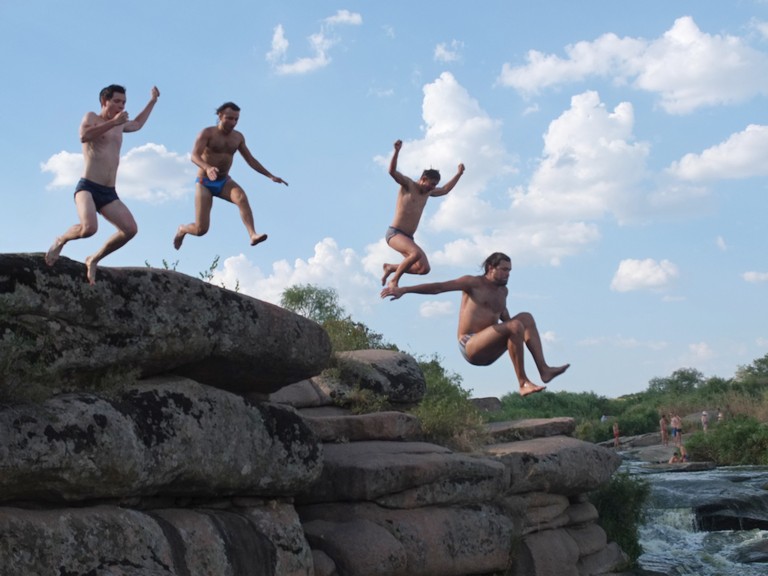
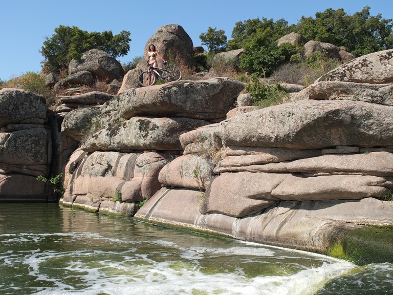
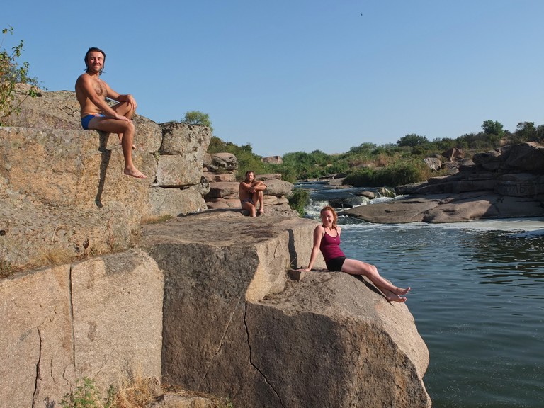
The Tokivski Waterfalls are a cascade of natural waterfalls on the Kamianka River, a tributary of the Bazavluk River, which in turn flows into the Dnipro. They are located near the village of Tokivske, where the river erodes the Ukrainian Crystalline Shield—an ancient geological structure that formed over 2 billion years ago.
Токівські водоспади
The total length of the waterfall cascade is 6 meters, making it a popular spot for swimming.